For many years, a large earthquake striking the Kathmandu Valley in Nepal has been a concern of disaster management and humanitarian assistance organizations throughout the region. Since 2012, Pacific Disaster Center (PDC) has worked with U.S. Army Corp of Engineers (USACE) and other organizations to enhance and increase Nepal’s internal GIS and data-sharing capacity to support disaster preparedness activities—hoping to ensure that critical data are available during a potential earthquake event.
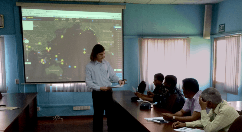
As it turns out—with no way to have guessed its timeliness—only days before a 7.8 magnitude earthquake struck the region, PDC and USACE held a Data Sharing Workshop in Kathmandu, Nepal. That event on 21 and 22 April contemplated a scenario very similar to what actually unfolded less than 72 hours later when the 7.8 M earthquake struck Lamjung.
The workshop was conducted as part of a multi-year initiative to implement tools and methods supporting access by Nepalese stakeholders to geospatial data holdings covering the region. This USACE-PDC joint project, called the Nepal Geographic Information System Integration Project, was undertaken in support of Nepal’s National Disaster Response Framework (NDRF).
Nepal’s Ministry of Home Affairs (MoHA) Disaster Management Division Joint Secretary Mr. Rameshwor Dangal opened the workshop. USACE Geographer Justin Pummell and PDC’s Director of Humanitarian Assistance Programs Peter Colvin led the activities.
Thirty-six representatives from Nepalese agencies and organizations that are providers and/or users of geospatial data in support of regional disaster management participated in the workshop. The meeting focused on best practices in data sharing and implementing a concept of operations built around the use of PDC’s DisasterAWARE. Overall, the project will increase access to regional baseline and dynamic data that can be used for response and recovery, and will enhance regional preparedness and mitigation activities.
Although the USACE-PDC team was fortunate to depart Kathmandu on Thursday (local time) before the earthquake struck the region on Saturday, they were acutely aware of the potential of such an event occurring. PDC efforts such as the Nepal GIS Integration Project will continue the work of improving and enhancing the capacity of Nepal to anticipate, respond to, and recover from such extreme natural events.
Learn more:
• Find PDC products about the 7.8M earthquake,
• Read about a 2014 Disaster Response Exercise in Nepal, or
• Visit ReliefWeb for additional sources and links.
Additional PDC news regarding the 7.8M earthquake in Nepal:
• Initial Damage and Needs Assessment in Nepal
• Food Security Concerns in Nepal Grow as Demands Exeed In-Country Supply
• Health Care Resources Stretched Beyond Capacity by Earthquake Injuries
• Data Access for Supporting Response and Recovery in Nepal
• Critical Data on Infrastructure in Nepal as Death Toll Rises
• 7.8M Earthquake Strikes Nepal, Followed by Aftershocks

