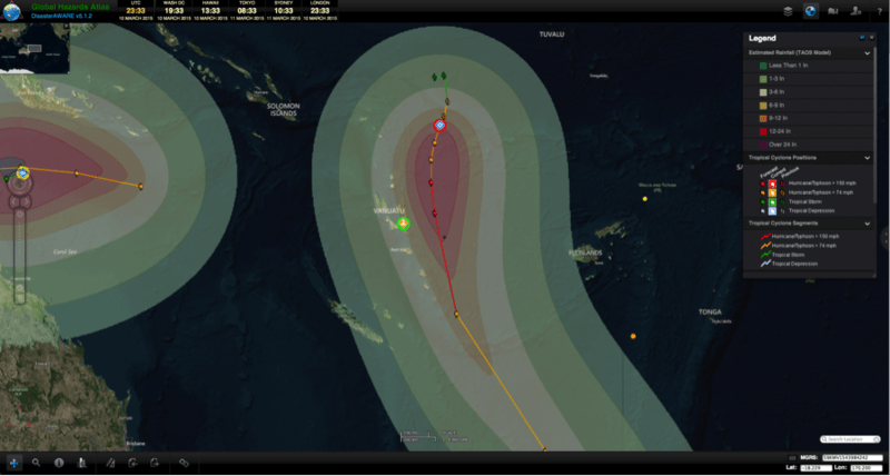
Tropical Cyclone Pam formed in the South Pacific Ocean on Monday, March 9, and is approaching the islands of Vanuatu with heavy rainfall and severe winds. The current track for TC Pam takes the building system dangerously close to the islands, potentially also affecting some areas of the Solomon Islands and Fiji. The Joint Typhoon Warning Center (JTWC) predicts that Pam will become increasingly powerful and strengthening into a dangerous category five tropical cyclone on the Saffir-Simpson wind scale. Meanwhile, NASA offers photos and graphics showing the extent of the cyclone in relation to the islands in the South Pacific.
As of Wednesday, March 11 (local time), the Vanuatu Meteorology and Geo-Hazards Department’s (VMGD), issued its first tropical cyclone warning for the provinces of Torba, Sanma, Penama and Malampa, expecting damaging gale-force winds, heavy rainfall, and very rough seas with heavy swells late in the day and into the night (local time). In the next 24 to 36 hours, these powerful winds are expected to affect both Tafea Province and the capital (and area of most concentrated population), Port Vila, in Shefa Province. Additionally, coastal flooding is expected in the northern provinces. The Government of Vanuatu advises residents in these provinces to listen to all radio broadcasts for the latest information on TC Pam.
In the Solomon Islands, the Meteorological Service Division has also issued a tropical cyclone warning for Temotu, Malaita, and Makira province. The Fiji Meteorological Service weather bulletin includes a strong-wind warning for land areas of Yasawa and Mamanuca Group, Vanua Levu, Taveuni and nearby smaller islands, and for the land and water areas of Rotuma.
For more information on Tropical Cyclone Pam:
• View the most recent forecast by JTWC,
• Visit the Vanuatu Meteorological Services website,
• Visit the Solomon Islands Meteorological Service Division website, and
• Visit the Fiji Meteorological Service website.

