Response and Recovery Support for the 2010 Haiti Earthquake
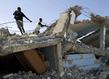
Access to reliable information plays a key role in effective response and is the first step toward meaningful recovery. On January 12, 2010, a 7.0-magnitude earthquake struck the Republic of Haiti, followed by at least 33 aftershocks. The devastating earthquake claimed more than 315,000 lives and left about one million people homeless.
Using geospatial data from trusted sources, PDC produced overview maps of Port-au-Prince and the surrounding communities and published the products through its DisasterAWARE® decision support platform. Assisted by satellite imagery released in the days following the earthquake, PDC analysts identified impassible roads, areas significantly impacted by collapsed infrastructure, and the locations of health care facilities and impromptu encampments of internally displaced persons. The maps and datasets provided rapid assessments to emergency responders, helping them to identify more suitable camp sites, to share the status of operational hospitals, to maintain awareness of safe and hazardous water resources, and to establish aid distribution centers. When a cholera epidemic spread throughout Haiti ten months after the earthquake, PDC used geospatial tools to help relief organizations identify both urgent needs—like clean water and medical services—and the needed resources, connecting people and communities with real solutions.

