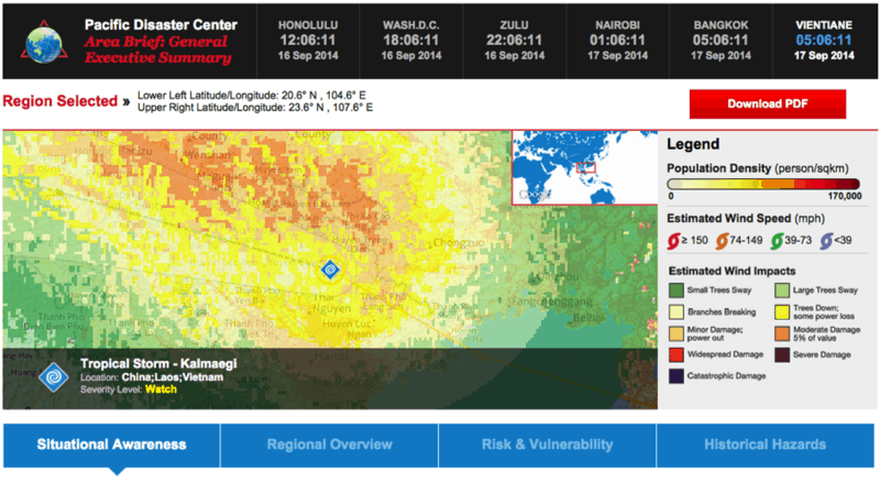
A hazard is not a disaster unless its impact overwhelms a population and/or assets of interest. Therefore, understanding as much as possible about the geography of a hazard, or potential hazard, is crucial for effective, analytical decision making.
Area Brief offers an abundance of resources for any selected area on the planet. This includes information on population, major cities, infrastructure, hazard profile, national resilience score, and much more. An Area Brief report is always attached to an Active Hazard, serving up real time data about location and impact, and augmenting it with other information aimed to increase overall situational awareness—such as a regional overview, statistical risk, and vulnerability data—and a summary of historical hazards. However, Area Brief also has the power to generate reports for any location with just a few simple mouse clicks.
In order to access Area Brief through an Active Hazard, simply hover over the hazard to access Map Tips, and click the icon as shown below.
Accessed with this method, Area Brief will automatically generate information for the area surrounding a hazard incident.
To create an Area Brief on demand for any location, use the Area Brief generator button on the map toolbar at the bottom of the viewer.
Once the generator is selected, you will need to select an area for the report. Choose between the rectangle or circle tool and define the area, no larger than 3 degrees, using the click-drag-release technique. A comprehensive report will be generated in seconds.
Area Brief will only include a Situational Awareness tab if the selection encompasses an Active Hazard. All other tabs, on the other hand, will always have useful information about the selected geography.
To save or share an Area Brief, click on the red Download PDF button in the top right-hand corner of the brief. Keep in mind that multiple Area Briefs can be created during a session, and will be listed in the Area Brief palette. These data compilations will be deleted upon logout.
For related information:
• Learn about DisasterAWARE Layer Controls,
• Learn about DisasterAWARE Layer Navigation,
• Learn about how to use DisasterAWARE Map Tips,
• Read about the DIY series initiated for National Preparedness Month,
• Visit the National Preparedness Month website and,
• Visit FEMA’s National Preparedness Community page.

