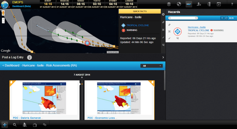
Final preparations are underway in the State of Hawaii for the arrival of Hurricane Iselle as the effects of the storm begin to reach the Big Island. Residents should continue to stay well-informed with the latest official reports and heed all instructions from local emergency management officials.
There are many resources available to increase preparedness and safety:
- Latest news releases can be viewed at the Hawaii Emergency Management Agency,
- Open shelter locations can be found at the American Red Cross,
- School closures are released from Hawaii State Department of Education and University of Hawai‘i,
- State office closures can be found at Hawaii.gov.
- Electrical safety tips and measures for before, during and after a disaster or power outage, are available from Hawaiian Electric Company, and
- Related releases and information on how to prepare for a water emergency are available from the Hawaii Board of Water Supply.
A hurricane warning remains in effect for Hawaii County, while the rest of the State, including Maui, Oahu and Kauai County are under tropical storm warning. In addition, the entire state is currently under a flash flood watch. According to the Central Pacific Hurricane Center (CPHC) of the U.S. National Weather Service (NWS), Iselle continues in a west-northwest direction and is expected to continue on this path through Friday, August 8. Iselle will move over the Big Island tonight and pass south of the rest of the state on Friday, bringing powerful winds, torrential rains, and large, dangerous surf. The latest advisory forecasts Iselle may weaken into a tropical storm tonight.
Behind Iselle, Hurricane Julio is tracking in a general west to west-northwestward direction that will be maintained through Saturday, August 9, according to the NHC. Julio is still expected to downgrade into a Category 1 hurricane as it crosses into the Central Pacific and again to a tropical storm as it nears the Hawaiian Islands. However, rainfall is currently considered the greatest threat, particularly considering the State will already have endured Iselle.
As more agencies begin to prepare for potential impacts, the tropical cyclones are gaining international and national attention. News correspondents have begun to arrive to capture the event. Pacific Disaster Center’s (PDC) Director of Disaster Services Dr. Erin Hughey, located on Maui, is scheduled for various media interviews over the next days. Others interested in scheduling an interview are welcome to make a request by contacting response@pdc.org.
We at Pacific Disaster Center hope that all our friends in Hawaii will listen to authorities and do everything they must to stay safe. We will be working throughout the storm to help share information and develop products that can support decision making.
For more information on Tropical Cyclone Iselle and Julio:
• Find out about how PDC is helping to prepare the state,
• Read a past update on TC Iselle and Julio,
• Visit the NWS National Hurricane Center for the latest updates,
• Take a look at information from NASA,
• Refer to NOAA’s explanation of the Saffir-Simpson Hurricane Wind Scale, and
• Explore FastFollow to receive SMS messages from DisasterAWARE.
More resources for hurricane safety and preparedness:
• Read about this year’s 2014 Central Pacific Basin Hurricane Season,
• Hawaii Hazards Awareness & Resilience Program (HHARP) to enhance community resilience,
• Read about how parents can help kids learn about disaster preparedness, and
• Find out about Hawaii’s Statewide Hurricane Preparedness Exercise.

