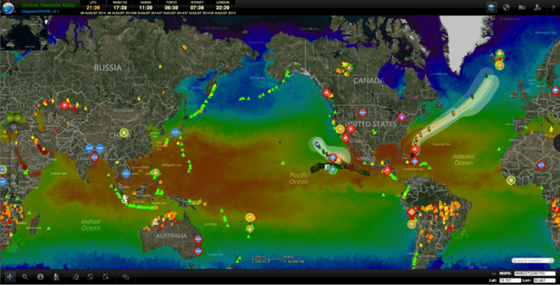
Themed “Be Disaster Aware, Take Action and Prepare,” September is National Preparedness Month, part of an annual campaign designed to encourage people to take steps to prepare for emergencies in their homes, businesses, schools, and communities. The Federal Emergency Management Agency (FEMA), an agency of the U.S. Department of Homeland Security (DHS), is the sponsor of the American campaign.
To contribute to this national effort, throughout September, PDC will highlight various features of its Global Hazards Atlas—the publicly accessible system powered by the DisasterAWARE platform—with releases here on pdc.org. These will include information on basic functionality of the Atlas, along with quick tips on how to access more information (via pop-ups, “Area Brief, ” etc.) to help you better understand the context (or impacts) of a hazard. From a standard internet browser, users can access this sophisticated geospatial environment at atlas.pdc.org.
DisasterAWARE is an early warning and decision support platform that continually monitors reliable scientific data sources for events deemed potentially hazardous to people, property, or assets around the globe and posts these incidents as “Active Hazards.” This highly interactive global map viewer displays real time information streams on multiple hazards; a range of geospatial data, such as population, infrastructure, and critical facilities; as well as models of potential impacts. By combining the information Atlas supplies, users can gain a better understanding of hazards around the world, including in their own region or community.
Stay Tuned!
(UPDATED) Access the DIY Preparedness Series
• DIY Preparedness: Map Tips
• DIY Preparedness: Layer Navigation
• DIY Preparedness: Layer Controls
• DIY Preparedness: Area Brief
For more information on FEMA’s National Preparedness Month:
• Visit the National Preparedness Month website,
• Visit FEMA’s National Preparedness Community page, and
• Look at what NOAA is doing to prepare.

