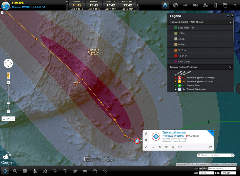
Typhoon Chan-hom formed in the western North Pacific on June 30, and is expected to affect Guam and the Northern Marianas (collectively known as The Marianas) with strong winds and heavy rainfall within the next 48 hours. According to the latest Public Advisory from the National Weather Service Forecast Office in Tiyan, Guam, Typhoon Chan-hom is expected to pass through The Marianas early Sunday morning (local time).
A Typhoon Watch remains in effect for Guam, Rota, Tinian, and Saipan, and residents are encouraged to begin preparing for severe weather conditions. In addition to typhoon force winds, dangerous surf and storm surge (up to 22 feet) are possible by Saturday evening. Heavy rainfall is also expected to increase the risk of flash flooding through Monday.
Earlier this year, Typhoon Dolphin impacted The Marianas, passing between Guam and Rota.
Pacific Disaster Center is closely monitoring Typhoon Chan-hom as it approaches The Marianas, and will continue to provide decision support and situational awareness products for the duration of the event. Keep up with the latest information via PDC’s Global Hazards Atlas, or with the Disaster Alert™ mobile application. If you are an emergency manager or humanitarian assistance practitioner and would like access to PDC’s DisasterAWARE platform, click here for more information.
For more information:
- Read this week’s Hazard Highlights
- Visit the PDC Weather Wall for regular updates
- See information from JTWC or the NWS Guam Forecast Office

