

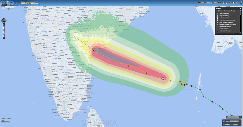
As Tropical Cyclone Lehar moves west across the Bay of Bengal, the India Meteorological Agency (IMD) has issued a national bulletin about the severe nature of the storm. The bulletin indicates that IMD expects extensive damage to makeshift homes, often made of mud (called “kutcha houses”), as well as disruption of power and communication lines, disruption of rail and road traffic, flying debris, flooding of escape routes, and extensive damage to agricultural crops. TC Lehar is expected cross the Andhra Pradesh coast around noon on November 28, local time.
As reported by the European Commission Humanitarian Aid department, TC Lehar is potentially much stronger than TC Helen, which struck the same area of coast about a week ago, forcing thousands to evacuate. TC Helen caused power outages and extensive damage to local agriculture. Now, with recently saturated soils, the area is considered more vulnerable to additional impacts. In a press release today, IMD warns that isolated “extremely heavy [rain] falls” are expected along with gale-force winds, reaching sustained speeds of 170-180 kph (105- 112 mph) gusting to 200 kph (124 mph).
Remarkably, on October 12, just about six weeks ago, India’s Bay of Bengal coast was hit by the most powerful storm to strike there in 14 years, TC Phailin. Despite significant damage caused by TC Phailin and TC Helen, the situation could have been much worse. India has achieved major advancements in its disaster risk reduction strategies, and now prepares for cyclones with early evacuations and the pre-positioning of emergency personnel and equipment.
For more information:
• Visit the PDC Weather Wall,
• Read a story about TC Phailin’s approach or post-impact,
• View recent NASA satellite images, and
• View the latest NOAA satellite images.