On the heels of National Preparedness Month, the world’s foremost provider of earthquake science and information, the U.S. Geological Survey (USGS), and Pacific Disaster Center (PDC) announced a Memorandum of Understanding to increase collaboration to deliver new earthquake monitoring, alerting, and impact modeling technologies. “We are excited about the expansion of this long-term partnership which spans more than a decade,” said PDC’s Director of Applied Science and Analytics Dr. Joseph Green. “Our organizations share a common goal of reducing death, injury, and property loss from earthquakes. Through this partnership, the new capabilities we develop and release into our DisasterAWARE platform will be used widely by PDC’s global disaster management and humanitarian partnership network to support their daily, life-saving operations.”
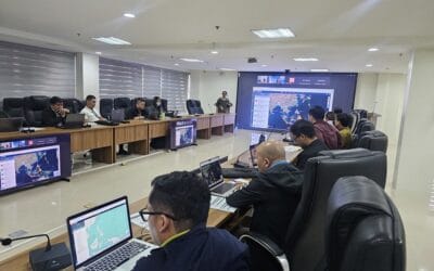
DisasterAWARE is PDC’s risk intelligence and early warning platform which provides hazard monitoring, real-time hazard notifications, situational awareness, and built-in impact modeling to support data-driven, evidence-based decision making.
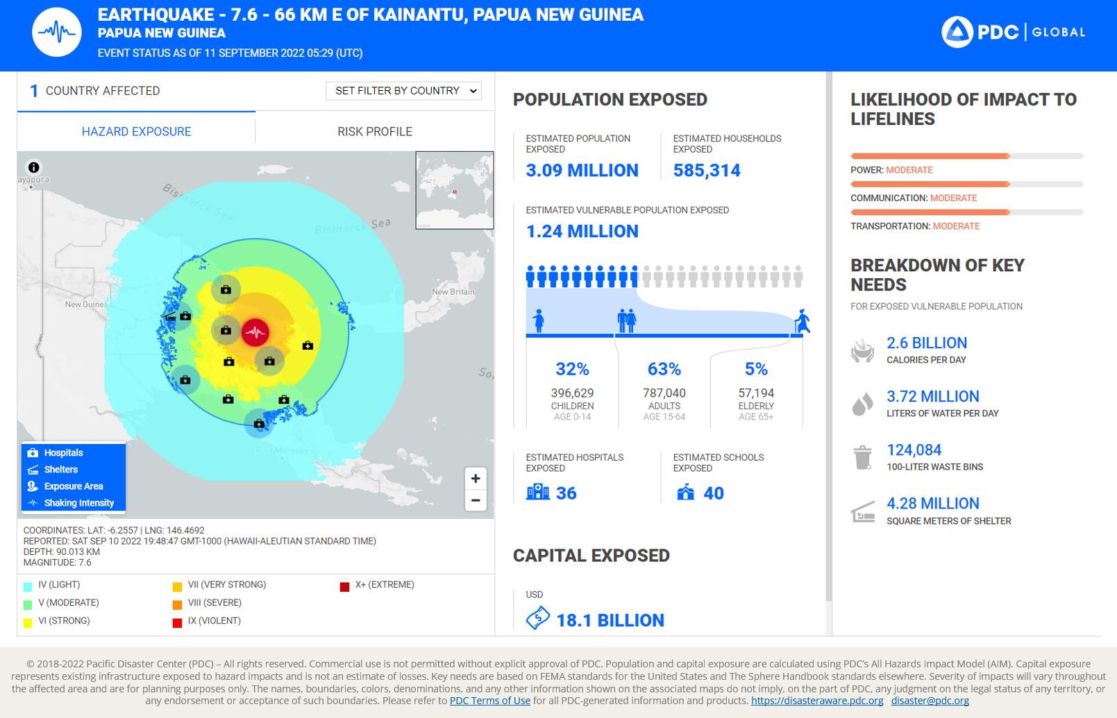
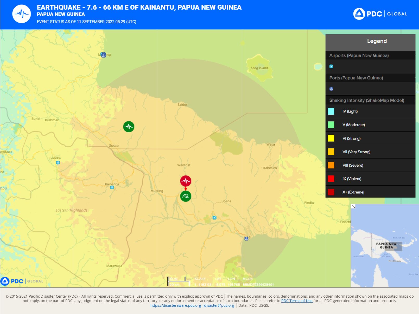
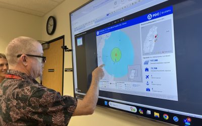
Pictured above: USGS information is integrated and displayed in PDC’s DisasterAWARE system. It is also used to populate the DisasterAWARE Event Brief—a built-in, real-time report used operationally by tens of thousands of disaster management and humanitarian assistance practitioners around the globe to determine potential impacts to population, critical lifelines and infrastructure.
“Over the years, we have developed several streamlined products and solutions to enhance the data and information flow related to earthquakes and other disasters. The PDC team has relied on these near-real-time USGS earthquake products to provide situational awareness to its expansive base of users and practitioners responding to large-scale earthquake disasters worldwide. We look forward to helping PDC enhance its exposure modeling and early alerting capabilities in the creation of a new joint analytical product,” said USGS Research Structural Engineer and a Lead Loss Model Developer of Prompt Assessment of Global Earthquakes for Response (PAGER) system at Geologic Hazards Science Center (GHSC), Dr. Kishor Jaiswal.
Research and collaboration between the two organizations aims to strengthen underlying data layers used by PDC and provide enhanced real-time analytics through DisasterAWARE about what happened, how bad the impact is likely to be, and what humanitarian action is needed. In addition to this main objective, there will also be a focus on USGS PAGER databases to further develop post-earthquake impact alerting.
PDC expressed enthusiasm about being able to collaborate with USGS PAGER scientists directly and to gain greater access to and understanding about National Earthquake Information Center (NEIC) products including their timelines and protocols for updates “that may be embedded directly into PDC’s DisasterAWARE alerts,” said PDC’s Executive Director, Ray Shirkhodai. Similarly, USGS GHSC Director Dr. Ryan Gold supports research opportunities that leverage PDC’s unique data layers to enhance NEIC products.