

 Your source for landslide hazard information
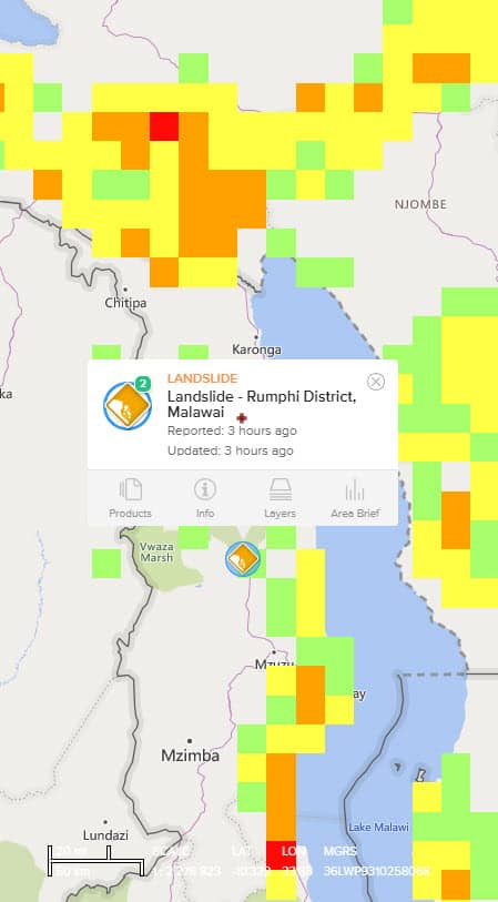
Our DisasterAWARE Pro platform, as well as our Disaster Alert™ public app, provides information about landslides happening around the world. Information is derived from a variety of scientific monitoring agencies.
Reporting Threshold
DisasterAWARE provides information about landslides which have occurred within a 24-hour period and pose severe impact to populations or infrastructure.
Coverage
Disaster Alert™ Mobile App
Disasters happen fast. We alert you faster.
(FREE for public use)

![]()
SmartAlert™ Advanced Early Warning for Landslides
DisasterAWARE Pro now includes PDC’s proprietary SmartAlert technology. You select the areas and hazards to monitor and we’ll alert you to threats within or approaching those areas automatically.
Alerting Severities:
Severity levels are designated by the authoritative reporting agency.
Available Formats
Professional versions: SMS Text | Email | App Alerts
Public version: App Alerts Only
Be Aware and Prepare
Always heed instructions from local authorities and receive alerts about major hazards from PDC’s DisasterAlert app or on the DisasterAlert website.
![]()
![]()

Act now
- Heed all warnings and evacuation notices.
- During a storm that could cause a landslide, stay alert and awake.
- If you do get stuck in the path of a landslide move uphill as quickly as possible.
- Avoid river valleys and low-lying areas during times of danger.
- If you are near a stream or channel, be alert for any sudden increase or decrease in water flow or water that changes from clear to muddy. These can be signs that a landslide is coming.
Plan ahead
Live in or plan to visit a landslide-susceptible area?
- Build an emergency kit and make a family communications plan.
- Connect with your local emergency services.
- Leave if you have been told to evacuate or you feel it is unsafe to remain in your home.
- Follow proper land-use procedures, such as avoiding building near steep slopes, close to mountain edges, near drainage ways or along natural erosion valleys.
- Become familiar with the land around you.
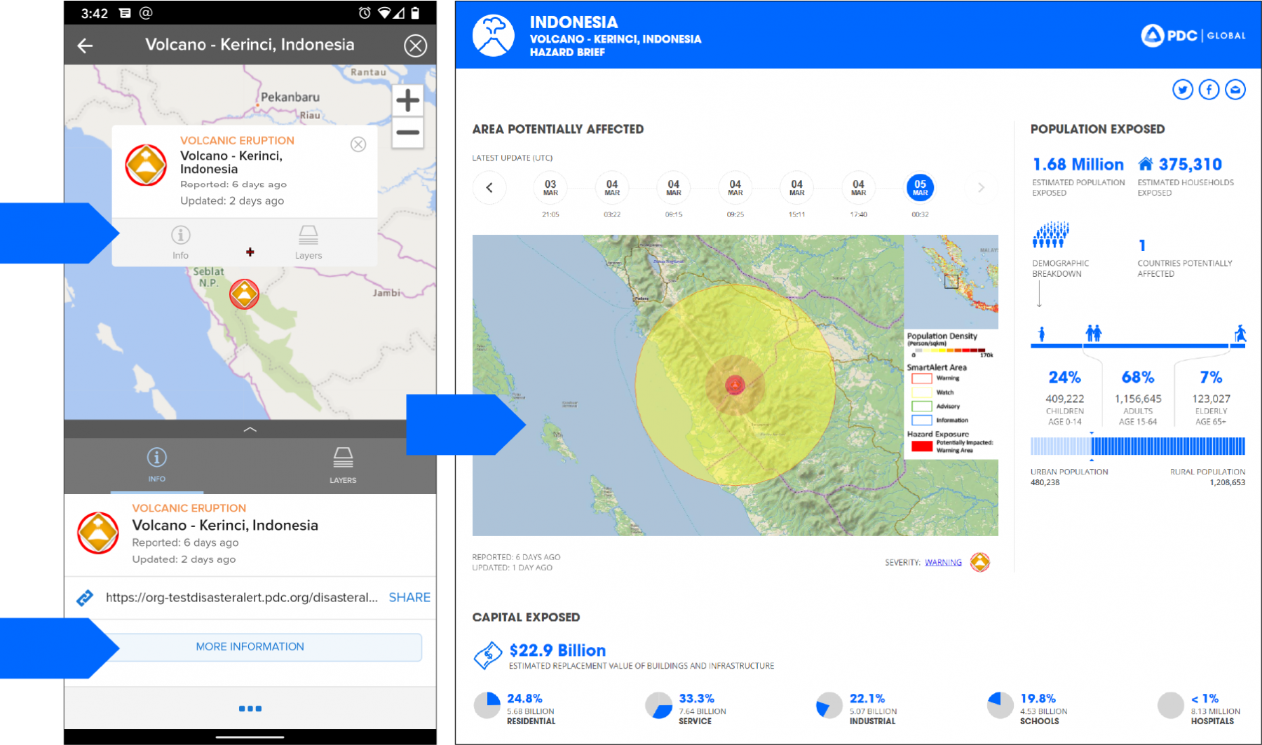
Hazard Brief
Real-Time Impact and Needs Assessment
Through DisasterAWARE Pro and Disaster Alert you get access to PDC’s unique exposure modeling capabilities—providing accurate assessments of exposure and need for hazards in any part of the world.
How to access Hazard Brief (available for all hazards)
Helpful Features and Layers
DisasterAWARE provides layers of information to help assess the impacts of landslides. These include but are not limited to:
• Rainfall accumulation (3 hour, 1 day)
• Landslide risk*
• Global weather observations (METAR)*
• Rainfall accumulation (3 day and 7 day)*
* = For disaster management practitioners only